Venezuela
Lieke Oude Wesselink
This contribution is published in both Dutch and English. You will find the English version below.
| Nummer Koeman’s Atlantes Neerlandici, vol. II | 9839:2:2 |
| Titel kaart / Titel tekst | VENEZVELA / Niev Andalvzien, En Venezvela |
Vanaf 1621 werd de Nederlandse handel in het Trans-Atlantisch gebied uitgevoerd door de WIC. In tegenstelling tot de VOC had de WIC niet een absolute grip op de handel in dit gebied. In de gebieden Terra Firma en Venezuela, waar deze kaarten van Blaeu in de Grooten Atlas over gaan, hadden de Nederlanders dan ook geen macht en slechts een beperkte rol in de handel. Deze kaarten gaan over het huidige Colombia en de landengte Panama en Venezuela en Guyana. Deze landen lagen onder koloniaal gezag van het Spaanse Rijk. De Spanjaarden leunden op de zilvervloot die zij hadden opgezet in het Atlantische gebied, en de tweede zilvervloot was de Terra Firma. Deze vloot kwam langs deze gebieden om zilver, goud en andere natuurlijke bronnen te halen en te vervoeren naar Spanje. Nederland was wel een beperkte tijd aanwezig in Venezuela om zout en rood hout te importeren, voordat de Spanjaarden hier een einde aan maakten.
Door de beperkte aanwezigheid van de Nederlanders in deze gebieden was er in de tijd van Blaeu ook niet veel aandacht voor. Daarnaast was er al een gedetailleerde beschrijving uitgegeven door Johannes De Laet, genaamd Beschrijvinghe van West-Indien. Blaeu besloot voor deze gebieden grotendeels te leunen op de beschrijvingen van De Laet. Ook de kaart die hoort bij de teksten van Blaeu over deze gebieden is overgenomen van De Laet.
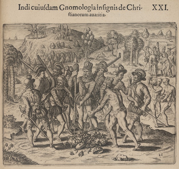
Jacques Le Moyne, Brevis narratio eorum quae in Florida Americae Provincia Gallis acciderunt (Frankfurt am Main: Johann Wechel, 1591), part 4, plate XXI: the Christians’ greed
Voor de teksten over Venezuela en dan specifiek de gebieden waar de “Hollanders” zout hebben gehaald heeft Blaeu wel actuelere tekst toegevoegd. Hieruit blijkt dat bij aanwezigheid van de Nederlanders Blaeu er wel belang bij had om nieuwere, actuelere teksten te selecteren. In de beschrijvingen bij de kaart van Terra Firma gaat het voornamelijk over informatie die relevant was voor de zilvervloot. Zo gaat het over de belangrijke steden voor de zilvervloot zoals de eindbestemming Nombre Dios in Panama, of de stad Cartagena die als een belangrijke plek diende voor de vloot, omdat er een beschutte en goed beveiligde baai lag waar schepen proviand konden inslaan.
Over de volkeren wordt voornamelijk geschreven dat ze kwaadaardig zijn of kannibalen, maar ook komen er stukjes tekst in de kaarten van Blaeu voor over bijvoorbeeld collaboratie tussen de oorspronkelijke volkeren en de Spanjaarden. De Spanjaarden hadden aanvankelijk de intentie om het gebied en de bevolking te koloniseren, maar zij gingen later over op het creëren van Europese enclaves.
Het blijft interessant waarom Blaeu er specifiek voor heeft gekozen om bepaalde informatie wel te over te nemen in zijn passages in de Grooten Atlas en andere voor handen zijnde informatie niet.
Suggestie om verder te lezen:
Emmer, P.C., & Gommans, J.J.L. (2020). ‘The Atlantic World’ in: The Dutch Overseas Empire, 1600–1800, pp. 125–244
| Koeman’s Atlantes Neerlandici, vol. II | 9839:2:2 |
| Title map / Title text | VENEZVELA / Niev Andalvzien, En Venezvela |
The Dutch West India Company took charge of the Dutch transatlantic trade in 1621. Unlike the Dutch East India Company in Asia, the West India Company was not in full control of the trade in this region. These maps from Blaeu’s Atlas Maior depict the areas Terra Firma and Venezuela. The Dutch had no power and played only a minor role in local trade in these regions, currently known as Colombia, the Isthmus of Panama and Venezuela and Guyana. These areas were under colonial control of the Spanish Empire, which relied on the treasure fleet it had set up in the Atlantic. Its second treasure fleet was the route to and from Terra Firma. This fleet sailed to Terra Firma to collect silver, gold, and other natural resources, and transport them to Spain. Before the Spanish put a stop to it, the Dutch were, in fact, in Venezuela for a limited time to mine salt and harvest redwood.
Since the Dutch presence in the region was sparse, Blaeu and his contemporaries were not much interested in it. Furthermore, Johannes De Laet had already published a detailed description of the region in his Beschrijvinghe van West-Indien [Description of the West Indies]. Blaeu decided to base his text of these regions largely on the descriptions by De Laet. He also used De Laet’s map of the area.
Blaeu did in fact add a more up-to-date text about Venezuela and specifically about the areas where the Dutch mined their salt. This shows that, if there was a Dutch presence somewhere, Blaeu was interested in using newer, more recent texts. In his texts accompanying the map of Terra Firma, he mainly provides information that was relevant to the treasure fleet. He names important cities on the maritime trade route, such as Nombre Dios in Panama, which was the final destination, or Cartagena, which served as a crucial port of call because it provided a secure harbour for ships to restock supplies.
Blaeu mostly describes the local population as evil or cannibalistic, but he also mentions alliances between the indigenous peoples and the Spanish. While the Spanish had originally intended to colonize the region and its inhabitants, they subsequently decided to create European enclaves.
The question remains why Blaeu specifically chose to include certain information in his descriptions in the Atlas Maior and decided to omit other available information.
Further reading:
Emmer, P.C., & Gommans, J.J.L. (2020). ‘The Atlantic World’ in: The Dutch Overseas Empire, 1600–1800, pp. 125–244
