Turkey
Gijs de Vries
This contribution is published in both Dutch and English. You will find the English version below.
| Nummer Koeman’s Atlantes Neerlandici, vol. II | 8110:2 |
| Titel kaart / Titel tekst | NATOLIA QUÆ OLIM ASIA MINOR / Natolia, Eertijdts kleyn Asien |
Het keizerrijk Turkije, ook wel bekend als het Ottomaanse Rijk, was een gebied dat meerdere regio’s besloeg en zich uitstrekte over de drie continenten Afrika, Azië en Europa. Twee van deze delen die door Blaeu in de Grooten Atlas specifiek worden benoemd zijn de regio’s Natolia en Palestina of het “Land van Belofte.” Natolia bestrijkt ongeveer het huidige Aziatische deel van Turkije en Palestina beslaat delen van Zuid-Libanon, Israël en de Palestijnse gebieden. Deze gebieden stonden in de tijd van Blaeu onder gezag van de eerdergenoemde Ottomanen of zoals ze destijds heetten: de “Turken”, wat echter ook een containerbegrip is dat in de vroegmoderne tijd standaard werd gebruikt voor moslims.
De religieuze focus in de regiobeschrijvingen van Turkije en Palestina voert duidelijk de boventoon. Zo heeft Blaeu het over ‘spottelijcke sotternyen’ als het gaat om het islamitische stichtingsverhaal. Ook rituelen en gebruiken die door hem als vreemd worden gezien, waaronder polygamie (het huwen van meerdere vrouwen door een man), beschrijft hij veroordelend. In het christelijke Europa was monogamie namelijk de norm.
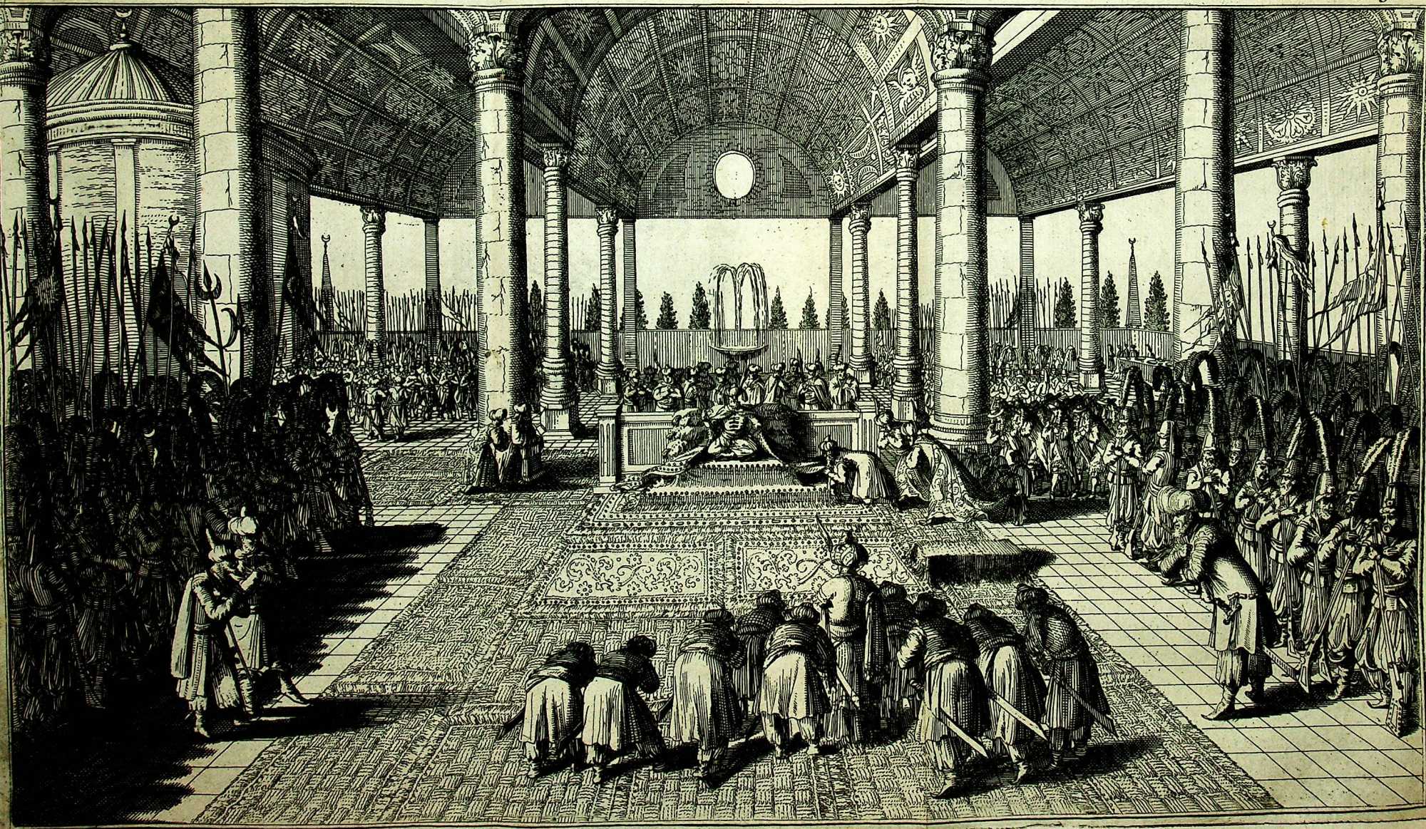 Jean Baptiste Tavernier, Nieuwe en naaukeurige beschryving van ‘t Serrail of Hof van de Turksche Kaizer (Amsterdam: Widow of Johannes van Someren, 1681)
Waar de religieuze aandacht in de beschrijving van het Ottomaanse Rijk vooral negatief en veroordelend is, vinden we in de religieuze passages over Palestina een sterke spirituele verwantschap met het gebied. Het zogeheten Heilige Land, of Beloofde Land, vormde immers de bakermat van het christendom. Blaeu beschrijft uitvoerig de plekken die verwijzen naar bijbelse verhalen, zoals de verwijzing naar de plaatsen Sodoma en Gammora, alsook de plek waar men stelt dat het Laatste Avondmaal (‘Paesch-lam’) werd genuttigd.
De focus op religie in de beschrijvingen van de Grooten Atlas van Blaeu en de achterliggende redenen voor deze focus zijn interessante aspecten die verder onderzoek rechtvaardigen.
Suggestie om verder te lezen:
Brummett, P. (2015). Mapping the Ottomans: sovereignty, territory, and identity in the Early Modern Mediterranean. Cambridge: Cambridge University Press.
The Turkish or Ottoman Empire was an area encompassing multiple regions on three continents: Africa, Asia, and Europe. In his Atlas Maior, Blaeu specifically covers two of these three regions, i.e. Natolia and The Holy Land, or Land of the Promised, formerly Palestine. Natolia corresponds mostly with the current Asian side of Turkey, and Palestine encompasses parts of South Lebanon, Israel, and the Palestinian territories. In Blaeu’s era, these regions were under Ottoman rule. The Ottomans were usually referred to as ‘Turks’, which was also an umbrella term for Muslims in the early-modern era.
Blaeu’s descriptions of Turkey and Palestine focus heavily on religion. He speaks of ‘spottelijcke sotternyen’ [ridiculous silliness] when addressing the origin of Islam. He is also dismissive of rituals and customs which he regards as outlandish, such as polygyny (men taking more than one wife), since monogamous marriages were the norm in Christian Europe.
Where Blaeu is mostly critical and dismissive of religion in the Ottoman Empire, the religious passages about Palestine reflect a strong spiritual connection with the area. The Holy Land or Land of the Promised was the cradle of Christianity after all. The map is full of biblical references and Blaeu describes in great detail the places mentioned in the Bible, such as Sodom and Gomorrah, as well as the place where the Last Supper took place.
The focus on religion in the descriptions in Blaeu’s Atlas Maior and the underlying reasons for this focus merit further research.
Further reading:
Brummett, P. (2015). Mapping the Ottomans: sovereignty, territory, and identity in the Early Modern Mediterranean. Cambridge: Cambridge University Press.
