South America
Wout Tannemaat
This contribution is published in both Dutch and English. You will find the English version below.
| Nummer Koeman’s Atlantes Neerlandici, vol. II | 9950:2B |
| Titel kaart / Titel tekst | TABVLA MAGELLANICA / Strate Le Maire |
Het onderste gedeelte van Zuid-Amerika, dat wij nu Argentinië, Chili, Paraguay en Uruguay noemen, was ten tijde van Blaeu’s Grooten Atlas ruim honderdvijftig jaar gekoloniseerd door de Spanjaarden. Conquistadores zoals Francisco Pizarro (1478-1541) en zijn opvolger Pedro Valdivia (1497-1553) veroverden op bloedige wijze grote gebiedsdelen voor goud, glorie en God, ongeveer in deze volgorde.
Het gebied is uitgestrekt en divers, maar krijgt in de Grooten Atlas slechts twaalf pagina’s toebedeeld. Zes van de pagina’s bevatten een summiere natuurhistorische beschrijving, informatie over grondstoffen, hoe de Spanjaarden er steden stichtten en andere ontdekkingsreizen. De oorspronkelijke bevolking komt alleen voor in de context van extractie, om te laten zien hoe groot het gezag was van de Spanjaarden of door te noemen welke naam een bepaalde plaats heeft in haar eigen taal. Welke mensen dat dan zijn, of wat hun culturele achtergrond is, blijft onvermeld. In de regiobeschrijving worden alle oorspronkelijke bewoners van dit gedeelte van Zuid-Amerika gecategoriseerd als “indianen”.
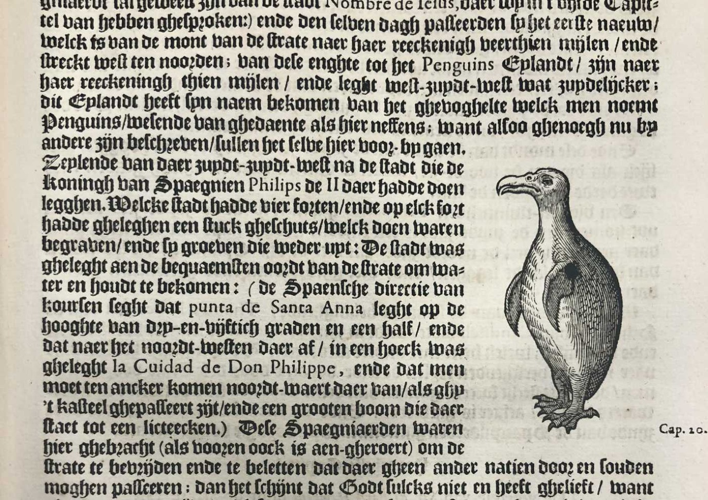 In his account of the West-Indies published at Leiden in 1630, Johannes de Laet incorporated a Dutch translation of Thomas Candisch’s description (made in 1586-1587) of the Strait of Magellan, including “Penguins Island” (p. 459).
Als er geen goud of zilver te halen viel, zag Blaeu het als een irrelevant gebied. Hij beschrijft namelijk wel wat de beste routes naar Potosí waren in zijn passage over de provincie Rio de la Plata. Het was voor tijdgenoten van Blaeu algemeen bekend dat in Potosí mijnen lagen waar een groot gedeelte van het Spaanse zilver vandaan kwam dat naar Europa werd verscheept. De verovering van de Spaanse zilvervloot door Piet Hein in 1628 heeft deze historie onderdeel gemaakt van ons collectief geheugen.
De overige zes pagina’s zijn kaarten van de gebieden waarbij vooral de kaart van Vuurland opvalt omdat deze amper is ingevuld, maar wel allerlei Spaanse en Nederlandse namen draagt waarbij ook “indianen” zijn afgebeeld aan de rand. Het is typerend voor de marginalisering van deze gebieden en de oorspronkelijke volkeren die er leefden.
Suggestie om verder te lezen:
Burkholder, M.A., & Johnson, L.L. (2010). Colonial Latin America (7th ed.). New York: Oxford University Press.
| Koeman’s Atlantes Neerlandici, vol. II | 9950:2B |
| Title map / Title text | TABVLA MAGELLANICA / Strate Le Maire |
The lower part of South America, present-day Argentina, Chile, Paraguay, and Uruguay, had been in Spanish hands for more than 150 years when Blaeu’s Atlas Maior was published. Conquistadores such as Francisco Pizarro (1478-1541) and his successor Pedro de Valdivia (1497-1553) caused widespread bloodshed in these areas in their effort to colonize them for gold, glory, and God – mostly in that order.
While the region is vast and diverse, Blaeu devoted a mere twelve pages to it in his Atlas. Six of these pages offer a concise description of the region’s natural history, and provide information about natural resources, about how and where the Spanish settled, and about other journeys of exploration. The indigenous population is mentioned only in passing, to demonstrate how great the power of the Spanish was or by referencing the name of a certain place in a local language. Who they were or what their cultural backgrounds entailed remains unsaid. In the description of the region, all indigenous peoples of this part of South America are labelled as ‘Indians’.
If an area did not produce gold or silver, it was irrelevant to Blaeu. In the passage about the province Río de la Plata, he does describe what the best routes to the city of Potosí were. It was general knowledge among Blaeu and his contemporaries that Potosí was one of the most significant mining sites that produced the Spanish silver that was transported to Europe. Dutch admiral Piet Hein’s capture of the Spanish treasure fleet in 1628 has until the present day a significant place in the collective memory of the Dutch.
The other six pages are maps of different areas. The most interesting of them is that of Tierra del Fuego because, while it is largely blank, it does show a variety of Spanish and Dutch names as well as an illustration of ‘Indians’ in the bottom left margin. This is a typical – and in this case, literal – demonstration of the marginalization of these regions and their indigenous peoples.
Further reading:
Burkholder, M.A., & Johnson, L.L. (2010). Colonial Latin America (7th ed.). New York: Oxford University Press.
